New Zealand having breathtaking views and amazing landscapes, the South Island is more famous for its mountains, lakes and glaciers. The Southern Alps, home to 3,724m-high Aoraki Mt. Cook, run along the entire length of the island. In the southwest is Fiordland National Park, with steep-sided Milford Sound.
My road trip in South Island started off from Christchurch on a rented vehicle.
Day 7: Heading off to Wanaka from Christchuch (through Tekapo)
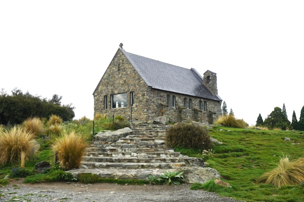
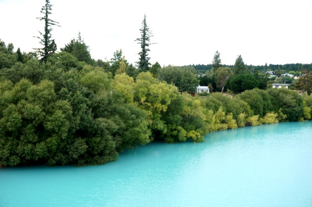
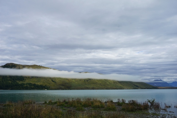
We set off early in the morning, our first stop was Lake Tekapo near Church of the Good Shepherd. Located on the shores of the beautiful Lake Tekapo, the Church of the Good Shepherd is nestled amongst the natural beauty of the region. Even though we arrived their before 9am, it was still crowded with tourists taking photographs. The turquoise-blue Lake Tekapo surrounded by snow-peaked mountains was a breathtaking site. It’s almost unreal milky blue colour comes from the glacial sediment left behind from a retreating glacier. (lupin flowers)
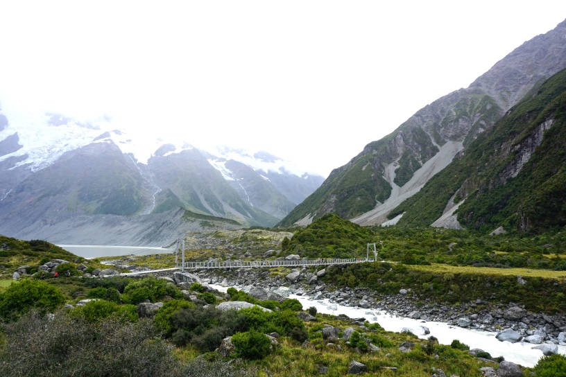
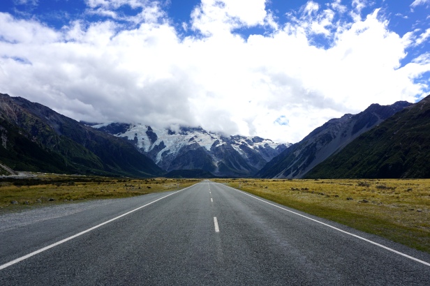
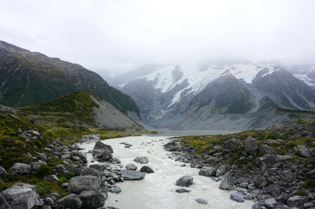
Next we headed to Aoraki/Mount Cook National Park to see the highest mountain in South island. Along the way the views were amazing. But unfortunately Mount Cook peak was fully covered with thick clouds and we were not able to see the peak.
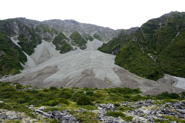
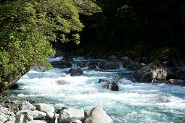
Hooker valley track is one of the most popular short hikes in New Zealand, which comes with some insane mountain views. It was an easy, mostly-flat gravel trail that is one of the nicest and most well-kept tracks.

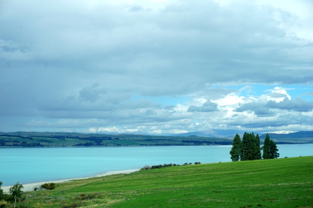
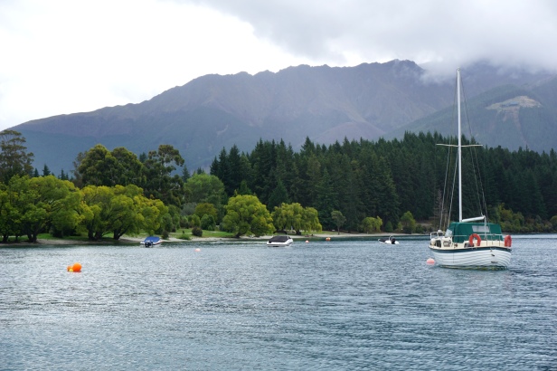
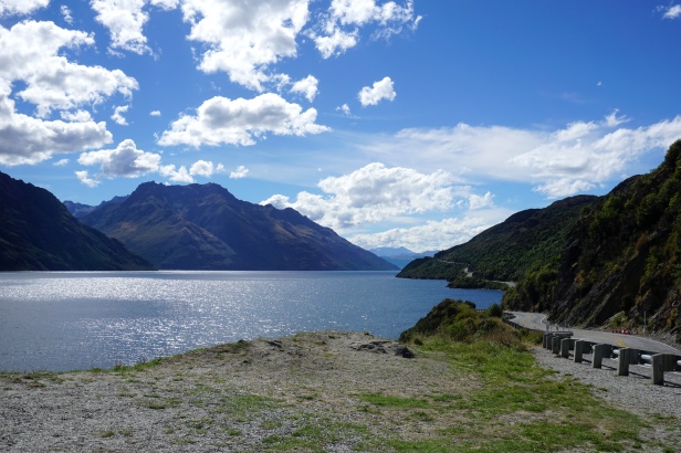
After the hike we set off to Wanaka. After checking into the place we went near the Lake Wanaka to have a quiet, clam and a beautiful evening.
Day 8: In and around Wanaka
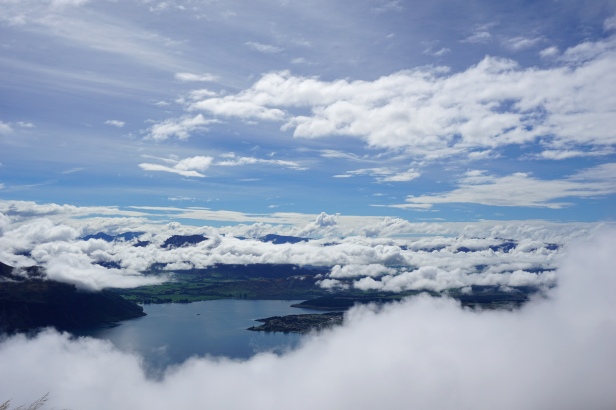
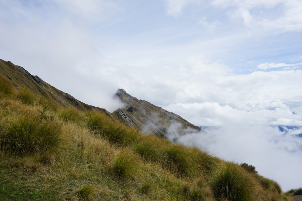
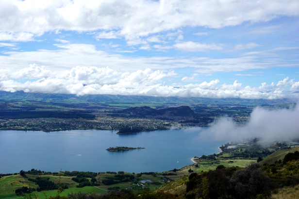
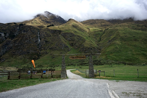
Next day it was time for another hike. And this time it’s a tough hike, Roys peak hike. The moment you start the hike, it’s a steep climb through a private farm. At the beginning thick clouds were covering the path an you cannot see the track ahead. After a while we passed the clouds and come to a clear area, and at a distance we could see the Lake Wanaka through the clouds. Even though the hike was really rough, the views were breathtaking and rewarding.
Tips: This hike is 8km one way. Take plenty of water with you and some snacks, but pack light as the track is very steep. Also layers of clothes as the weather can change quickly. There is one toilet near the car park, but after that until you return there are no toilets.

After the hike, we drove a bit further to see Diamond lake and . Then it was time to relax near the Lake Wanaka and enjoy our stay.

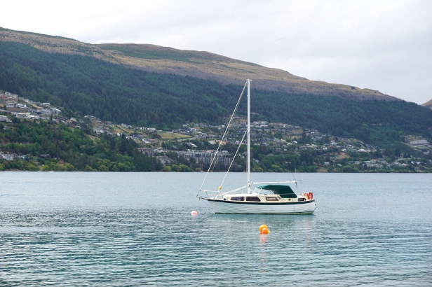
Day 9 : To Queenstown and Te anau
We drove to Queenstown in the morning. It was such a beautiful day to spend some time near the lake. And go up the Skyline Queenstown for great views and do some Luge riding 😀


We drove around the nearby areas enjoying the beautiful views.

Then it was time to head to Te anau to stay over the night so that we can head to Milford sound early in the morning. For anyone who is planning to take a early morning ferry ride in Milford sound, I would recommend spending the previous night in Te anau to save time.

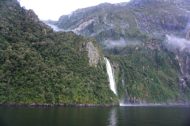
Day 10 : Milford Sound and returning back home
“Milford Sound runs 15 kilometers inland from the Tasman Sea at Dale Point (also named after a location close to Milford Haven in Wales)—the mouth of the Fiord—and is surrounded by sheer rock faces that rise 1,200 meters (3,900 ft) or more on either side. Among the peaks are The Elephant at 1,517 meters (4,977 ft), said to resemble an elephant’s head, and The Lion, 1,302 meters (4,272 ft), in the shape of a crouching lion.
Milford Sound sports two permanent waterfalls, Lady Bowen Falls and Stirling Falls. After heavy rain temporary waterfalls can be seen running down the steep sided rock faces that line the fiord. They are fed by rain water drenched moss and will last a few days at most once the rain stops.” – wiki
That was the end of one awesome trip. I returned back home hoping to go back one day for more 🙂
To read about the North island of New Zealand, click here
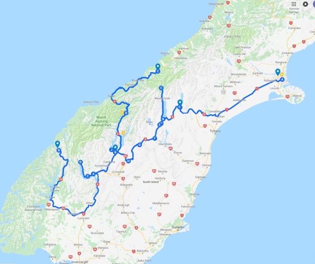
Road trip plan – map